A couple severe storms possible Wednesday afternoon and evening
-A couple severe thunderstorms are possible Wednesday afternoon and evening
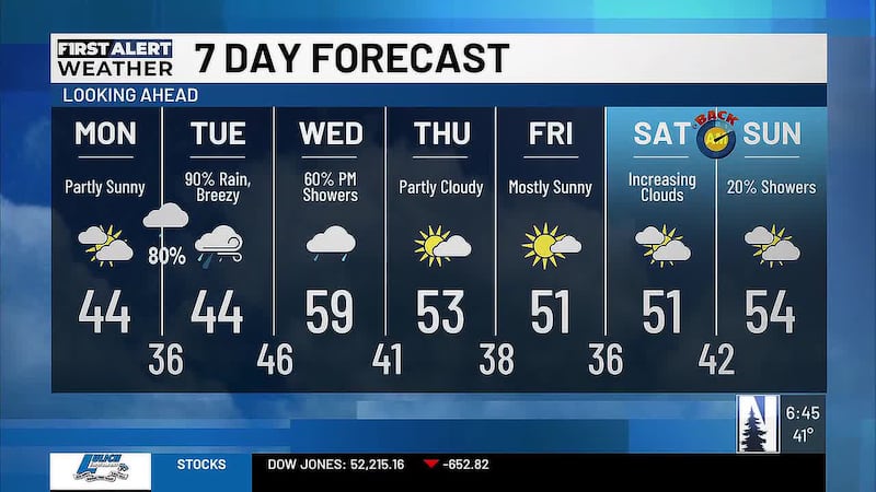
-Drier with more sunshine for the second half of the week
-Halloween brings a slight chance for rain
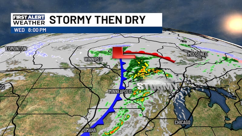
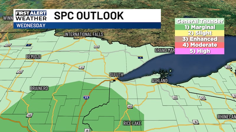
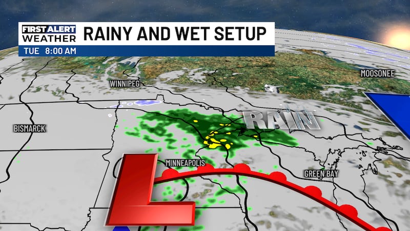
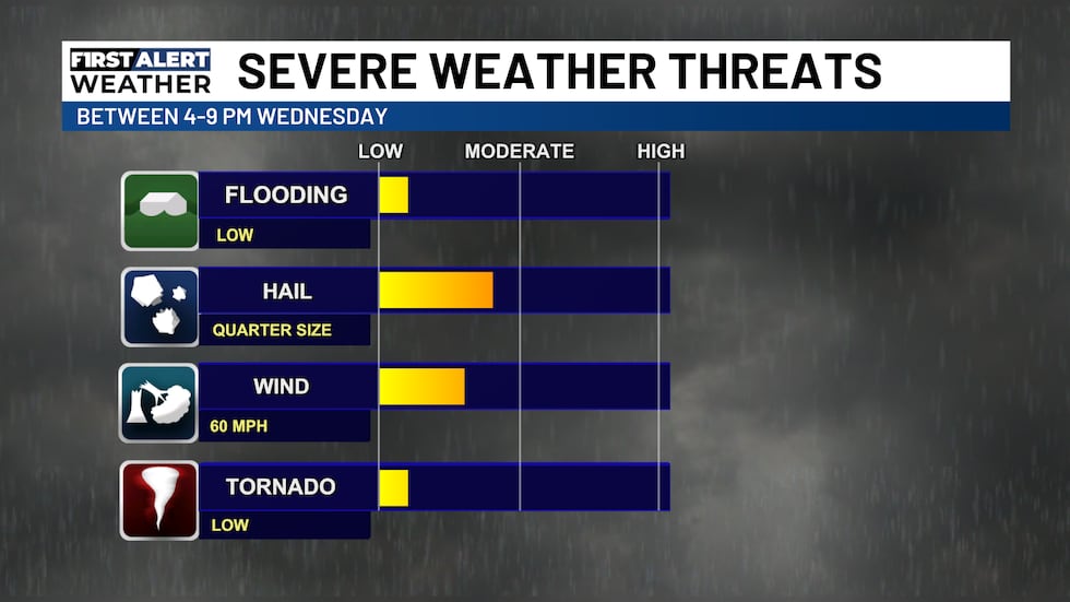
WEDNESDAY AFTERNOON/OVERNIGHT: An area of low pressure with an associated cold front will move through the Northland this evening. This will bring late-season thunderstorms to the region with the possibility for a couple severe thunderstorms. The best chance for severe weather will be south of the Twin Ports in NW WI and East-Central MN between 4 and 9pm. The main threat would be large hail, but an isolated tornado or two cannot be ruled out along with brief strong wind gusts. Clouds decrease after 10pm with lows in the 30s.
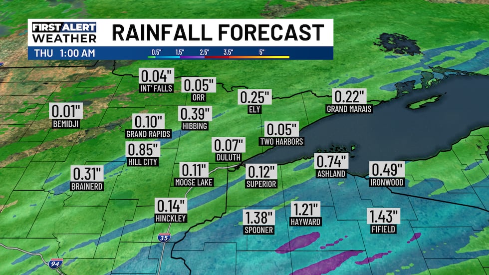
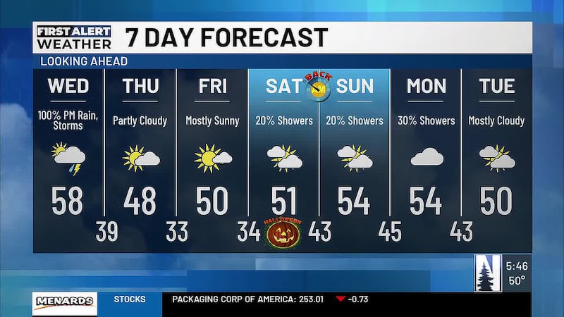
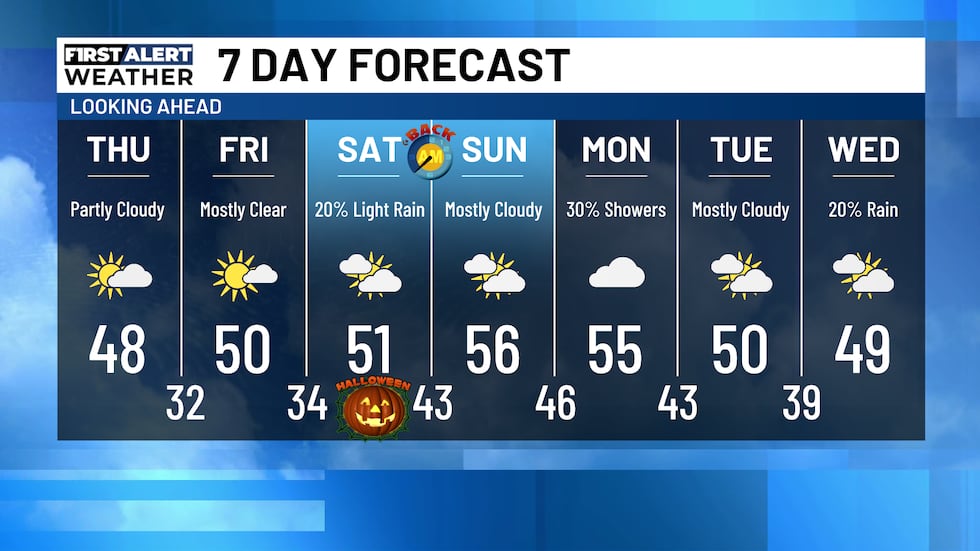
THURSDAY: High pressure returns bringing mostly clear to partly cloudy skies for the majority of the region. Some cloud coverage may linger in NE MN through the early afternoon. Highs will be in the 40s and 50s with lows in the 20s and 30s.
FRIDAY: Mostly clear skies continue with highs in the 40s and 50s. Lows will be in the 20s and 30s with increasing clouds into Saturday morning.
HALLOWEEN SATURDAY: The bulk of the day will be mostly cloudy with highs in the 40s and 50s and a slight chance for very light and scattered rain. A 20% chance for rain continues during trick-or-treating time with temperatures in the 40s.

Click here to download the Northern News Now app or our Northern News Now First Alert weather app.
Copyright 2026 Northern News Now. All rights reserved.