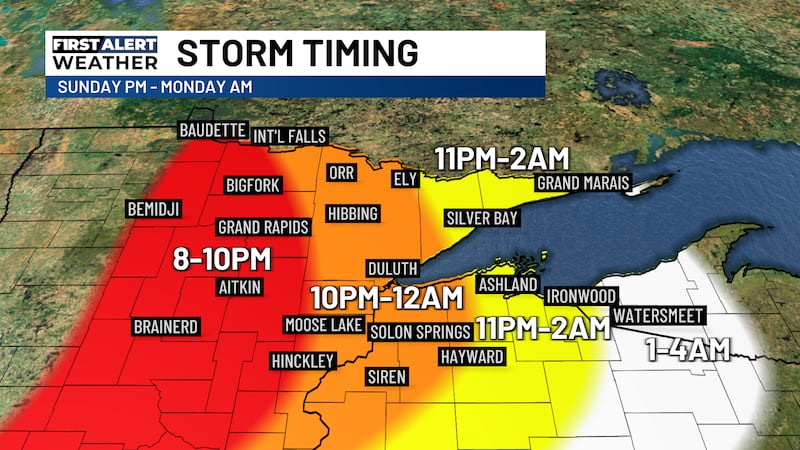
First Alert: Widespread snow brings slick travel Sunday evening into Monday
FRIDAY EVENING: Relatively calm conditions continue with patchy fog. Lows will be in the 20s with light winds out of the SE at 3-6 MPH.
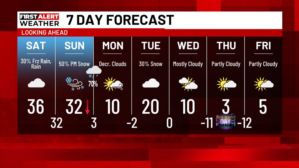
SATURDAY: A chance for rain and freezing rain will return to the Northland. The best chance for very light freezing rain will be north of Duluth during Saturday afternoon. Roads could become slick. Highs reach the 30s with mostly cloudy skies.

SUNDAY: Temperatures begin in the 30s just after midnight with gusty winds developing by the early morning. This will cause temperatures to fall into the teens by the mid-afternoon. A chance for snow returns late in the morning with more widespread snowfall arriving in the afternoon and evening. The heaviest snow will be overnight into Monday along the South Shore east of the Twin Ports. Most areas in MN will see 1-4″ of new snow. 4-8″ will be possible in much of NW WI. The South Shore could see between 8-16″, with locally higher amounts possible.

MONDAY: Lake effect snow continues along the South Shore east of Ashland as gusty winds bring cold temperatures. Highs reach the single digits to teens above zero. Lows will be in the single digits to teens below zero.
Click here to download the Northern News Now app or our Northern News Now First Alert weather app.
Copyright 2025 Northern News Now. All rights reserved.